LADEE Orbit Determination – How we Find Where LADEE is, and Where it’s Going
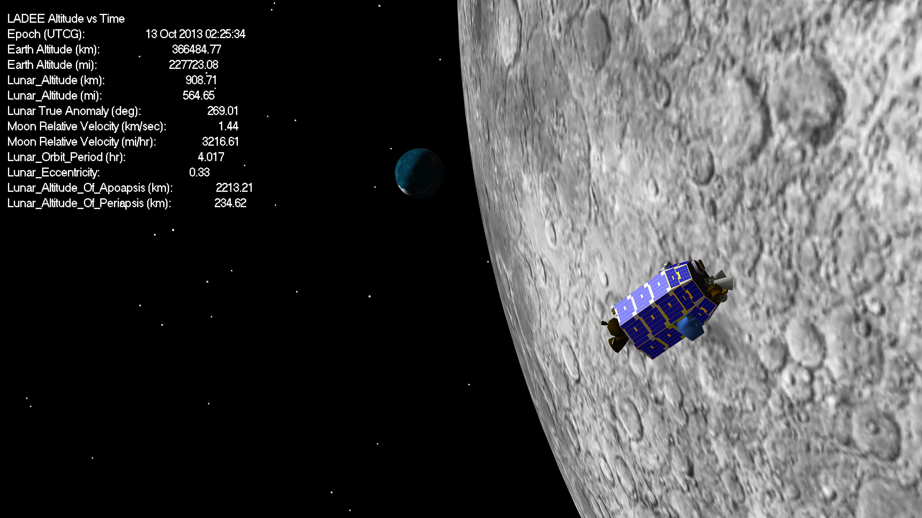
Part of an astrogator’s job is to determine the spacecraft’s current orbit, and predict where it will be in the future, just as the navigators on sailing ships figured out where their ship was and where they were going. Those navigators used star sightings, Sun observations, and accurate clocks to figure out their latitude and longitude. One of the ways they calculated their speed was to drop floats into the water and time how long it took for the ship to move a measured distance. On LADEE we also take observations and measurements to figure out where LADEE is. These measurements are called tracking data, which we receive from many ground tracking stations which are positioned around the world. We use large dish antennae from NASA’s Near Earth Network, NASA’s Deep Space Network, and from the commercial Universal Space Network. We schedule time each day for the various ground stations to track LADEE, using radio signals, and they send us tracking data files containing their measurements during and after the pass. In these files we can get the ground station’s observations of the distance to the spacecraft (“Range”); the speed at which the spacecraft is moving towards or away from the ground station (“Doppler” or “Range Rate”); and the angles in the sky where LADEE is, from the ground stations’ point-of-view. We don’t always get all these types of measurements, nor do we get tracking data all the time, but we don’t always need to. (We will never say no to more tracking data, though. We like it when the controllers schedule extra time to communicate with the spacecraft because then we get more tracking data! We often exclaim, “More Data!”) After we get the tracking data, we use a first guess at what we think the orbit is currently, and we estimate a new orbit by adjusting the trajectory slightly to fit the new measurements. We use AGI’s Optimal Extended Kalman Filter, (in Orbit Determination Tool Kit, aka “ODTK”) to read these files and estimate LADEE’s orbit. We’ve used this on many other cislunar and Earth orbits before, and it really works great!
The end result of our orbit determination work is a spacecraft ephemeris file of where LADEE has been in the past, and another ephemeris file of the predicted orbit, which is where we think LADEE will be in the future. The ephemeris file of the past trajectory is sent to the scientists who need to know where LADEE was when it took their science measurements. The predicted ephemeris file is used by the mission planners for scheduling their activities. It’s also used by other astrogators to calculate “acquisition” data to send to the ground stations so they know where and when to point their antenna to track LADEE. And it’s used by other astrogators to plan the next orbit maneuvers and attitude orientation plans.
It’s very important that we calculate accurate orbits, and we have some pretty tight requirements on how accurate our past orbit knowledge must be, as well as how accurate our predicted orbit must be. As you might imagine, since the tracking is done using radio waves, the signals can have noise on them. The signals are affected by things like weather (one of the ground station dishes was struck by lightning a few weeks ago!). The electronics on the spacecraft also are affected by the harsh temperature changes in space. To make sure our orbit is accurate we spend a lot of time “tuning” the filter settings. This includes identifying and throwing out bad data, calculating how much noise is on each measurement, and calibrating bias values for the various tracking electronics. Also, every time there is a maneuver, whether a large orbit burn, or a small momentum dump, we have to calibrate that maneuver and estimate its exact magnitude and direction. It’s been very rewarding working with the other LADEE astrogators that do this orbit determination work: Craig Nickel, Ryan Lebois, and our Orbit Determination lead, Lisa Policastri. They have done a great job, preparing for years before we launched, and since have been working long hours on crazy shift schedules during operations to make sure we know where we are and where we are going! We have a lot of discussions on how the data look, what the biases might be, and things to try to make our orbit solutions better. (Some conference papers we’ve written describing the details of how we’ve done Orbit Determination for other missions can be found at http://www.applieddefense.com/resources/white-papers/ )
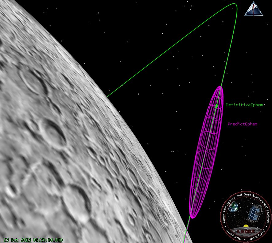
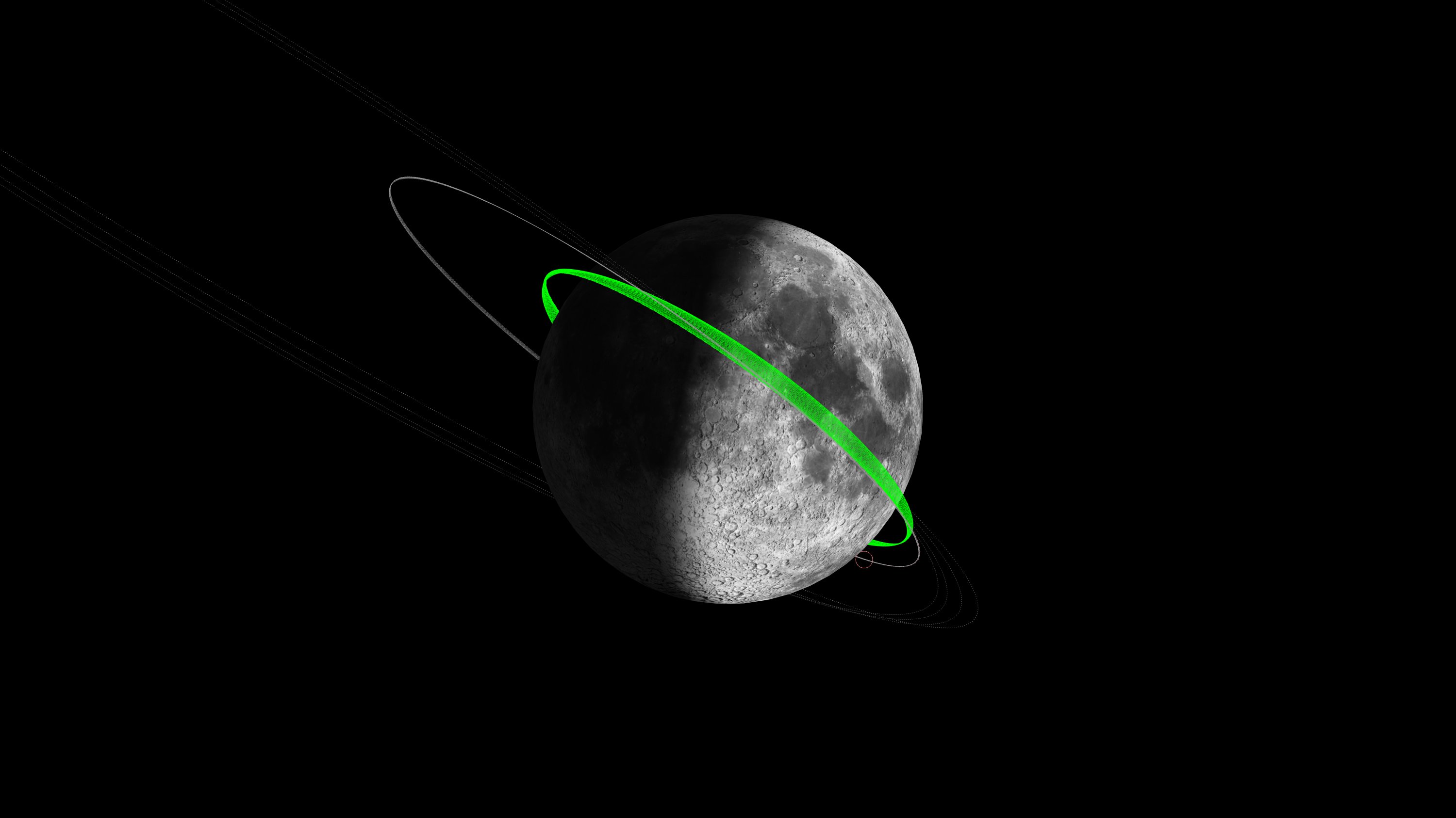
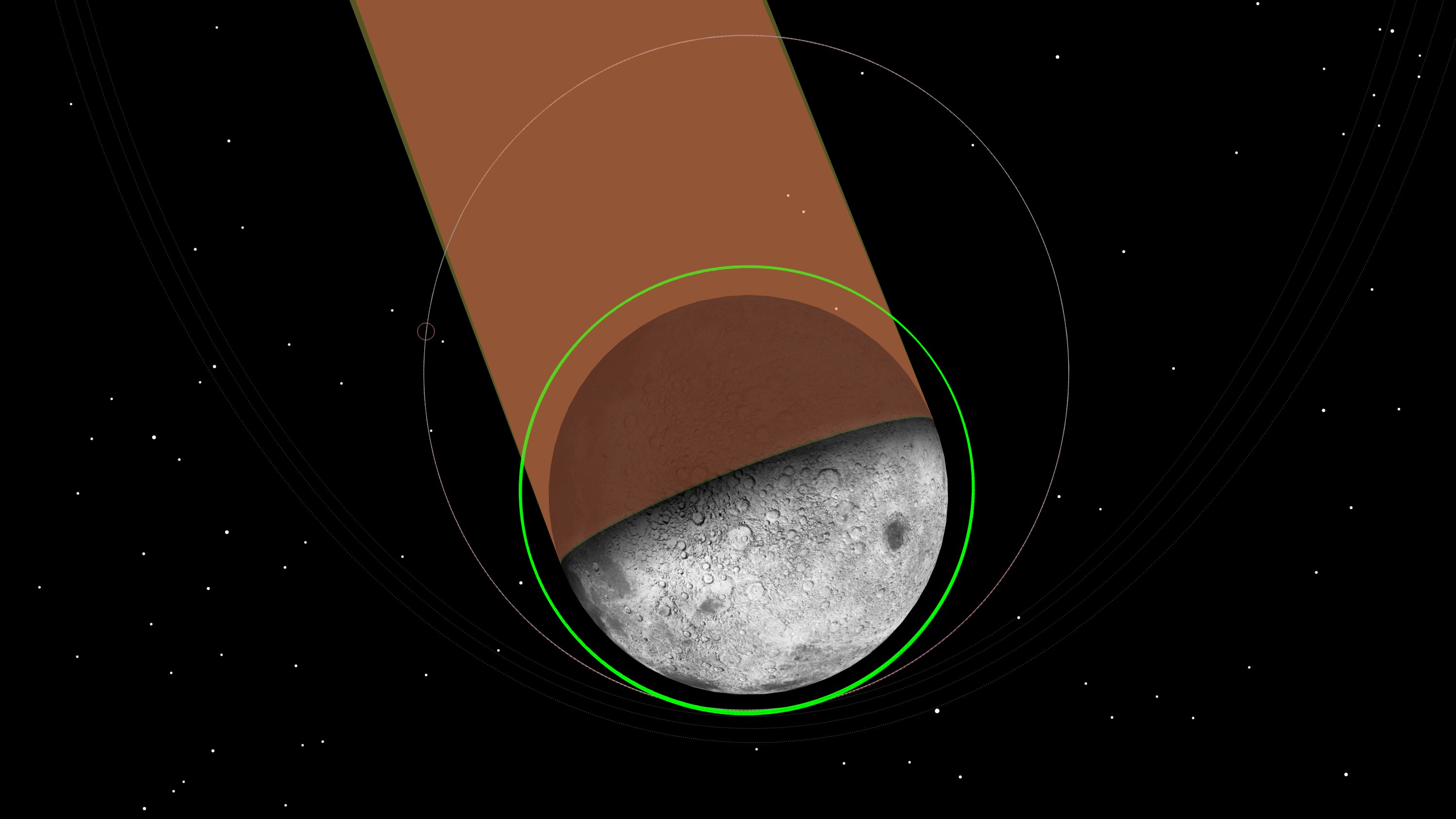
The LADEE OD team compares the orbit prediction (Purple) from a few days ago with the current solution (Green), making sure that the predictions are accurate enough to support communications and LLCD pointing activities.
After we get an orbit solution, we then go through a lot of self-consistency checks to convince ourselves that our orbit is good, and we check our previous predictions with new data to see how well we are doing (as shown in these figures.) It is frustrating, though, that we can’t just look out a window and see where LADEE really is! Sometimes it seems like we are flying a remote control airplane with a blindfold on, maneuvering by only listening to the sound of the engine as it gets closer or farther from us!
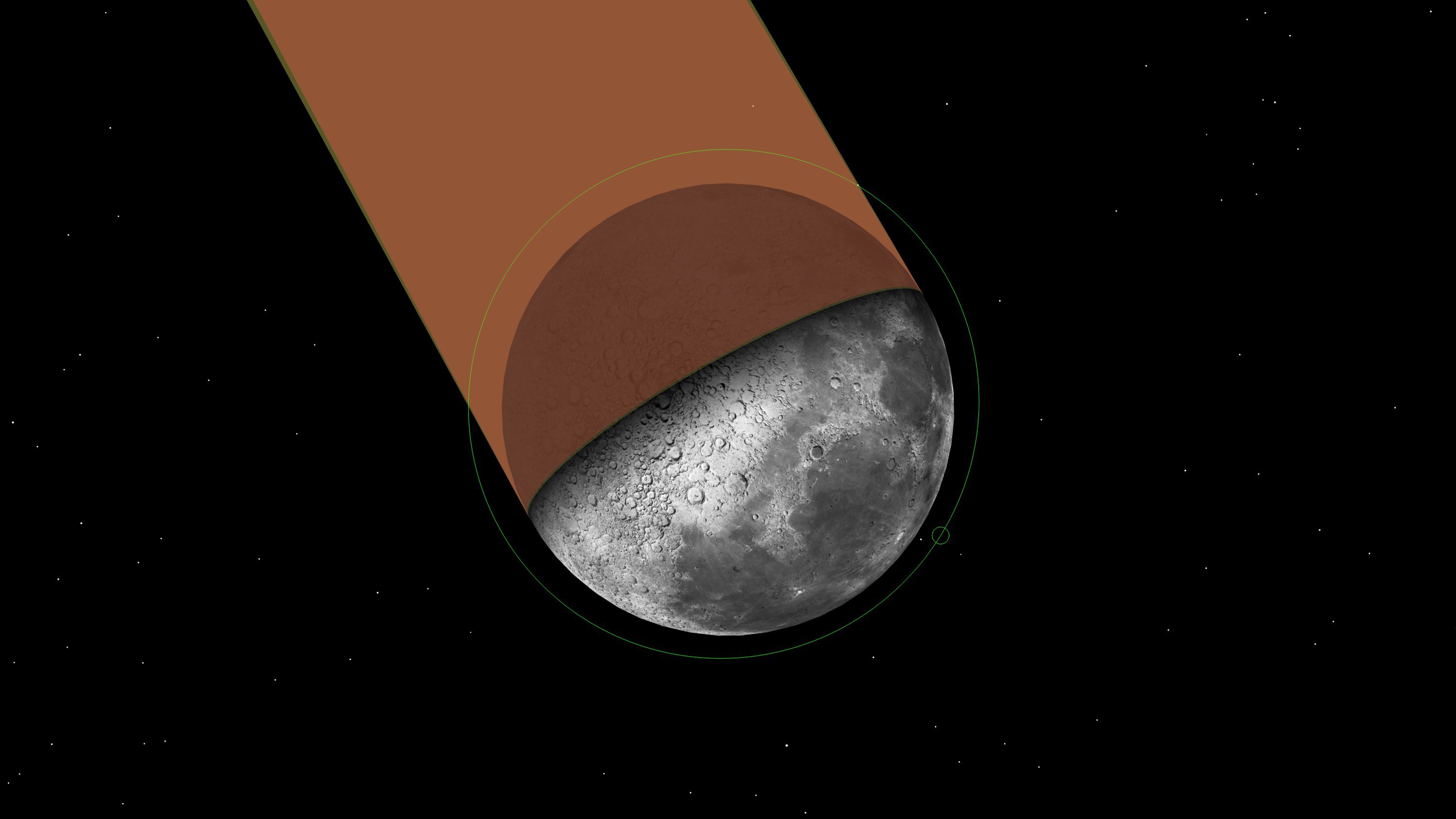
Every once in a while, though, we get a good indication that things are going well. For example, when we were getting ready for our first Lunar Orbit Insertion burn, we were sure everything was going well, but there’s still a lot of anticipation in the air…. we were leaving the Earth’s dominating gravity, and falling rapidly towards the Moon. (“Falling with Style” as Buzz Lightyear would say!) We designed LADEE’s trajectory to go behind the Moon and—based on our predictions—we planned the exact time for the main engine to fire to brake into Lunar orbit, igniting just a few minutes after LADEE became visible again from behind the other side of Moon. We sure hoped we got the prediction correct! In addition to estimating the time LADEE would lose signal as it disappeared behind the Moon, we also estimated the uncertainty in that time; we predicted we knew the time within 2 seconds. We were listening to the other team members on the voice loop, and we cheered as they called out that the Loss Of Signal was within 2 seconds of our prediction!

The LADEE OD team calculates the uncertainty of each orbit solution. One consistency check we perform is to see that the difference between the predicted and final orbit estimates are close compared to their uncertainties. The uncertainty of the predicted orbit is shown in Purple, and the uncertainty of the current “definitive” solution is in Green. In this case, the final definitive orbit and it’s uncertainty is completely within the predicted uncertainty. This is an indication that the prediction a few days ago is still good to use now.
Then came the Lunar Laser Communication Demonstration (LLCD experiment), a great deep space technology that has now been successfully demonstrated. (A cool video here: http://youtu.be/ptfLfrWI648 and the NASA web page is here: http://llcd.gsfc.nasa.gov ?). When they started the first experiment, it just worked! As quoted in the article from Popular Mechanics: (http://www.popularmechanics.com/science/space/nasa/lunar-laser-communication-experiment-succeeds-16068586):
“We thought the ground terminal would have to do a little searching, but it turned out it was pointed perfectly,” Boroson says. “We turned it on and all cheered.” The connection was almost instantaneous. After the spacecraft and ground terminal connected, a 4-inch laser beam travelled 238,000 miles from the moon to New Mexico.
And in the article from Spaceflight Now: (http://spaceflightnow.com/minotaur/ladee/131023laser/#.Ummt-_mTh8F):
Over the 239,000-mile distance between the Earth and the moon, the 4-inch-diameter laser column disperses to a width of 3.5 miles by the time it reaches the ground.
There was really little room for error: the pointing had to be correct, and the predicted ephemeris has to be accurate. Although we had done several tests prior to launch, sending test products to check out the system, we didn’t know how things would work until they turned on the LLCD system. You can imagine when we heard over the voice loops and in the status briefings last weekend that the orbit ephemeris was good enough that the system worked right away, and that they didn’t need to search, we were very excited!

Our LADEE Orbit Determination lead, Lisa Policastri, visited the NASA Wallops Flight Facility prior to launch. She is standing here in front of the LADEE display, and you can see the LLCD display on the left.
The orbit determination team really did their job! And, in addition, our nine-person Flight Dynamics Team performed several other tasks to make the LLCD experiment work. We calculate the orientation (also called the “attitude”) of the spacecraft for the experiments. We also create the on-board spacecraft ephemeris so the LLCD instruments mounted on LADEE know where and when to point back at the ground terminals on Earth. And we generate the pointing angles for the ground terminals to point their LASERS at LADEE. Of course, we’re not the only ones… Our flight dynamics team sits in the room next to the activity planners, and the many sub-system engineers, and we are near the controllers, and the many other folks that worked through the weekend and over long nights at Ames to make this successful. It was an exciting weekend!
And that’s just listing some of the folks at NASA Ames. To see the rest of the LLCD team, check out the web page http://llcd.gsfc.nasa.gov – It really is great to see what can be accomplished when so many people, of very different talents, have a chance to work together, and try something new.